
Map Shows Aboveground Woody Biomass in Mainland United States
Posted on January 13, 2012
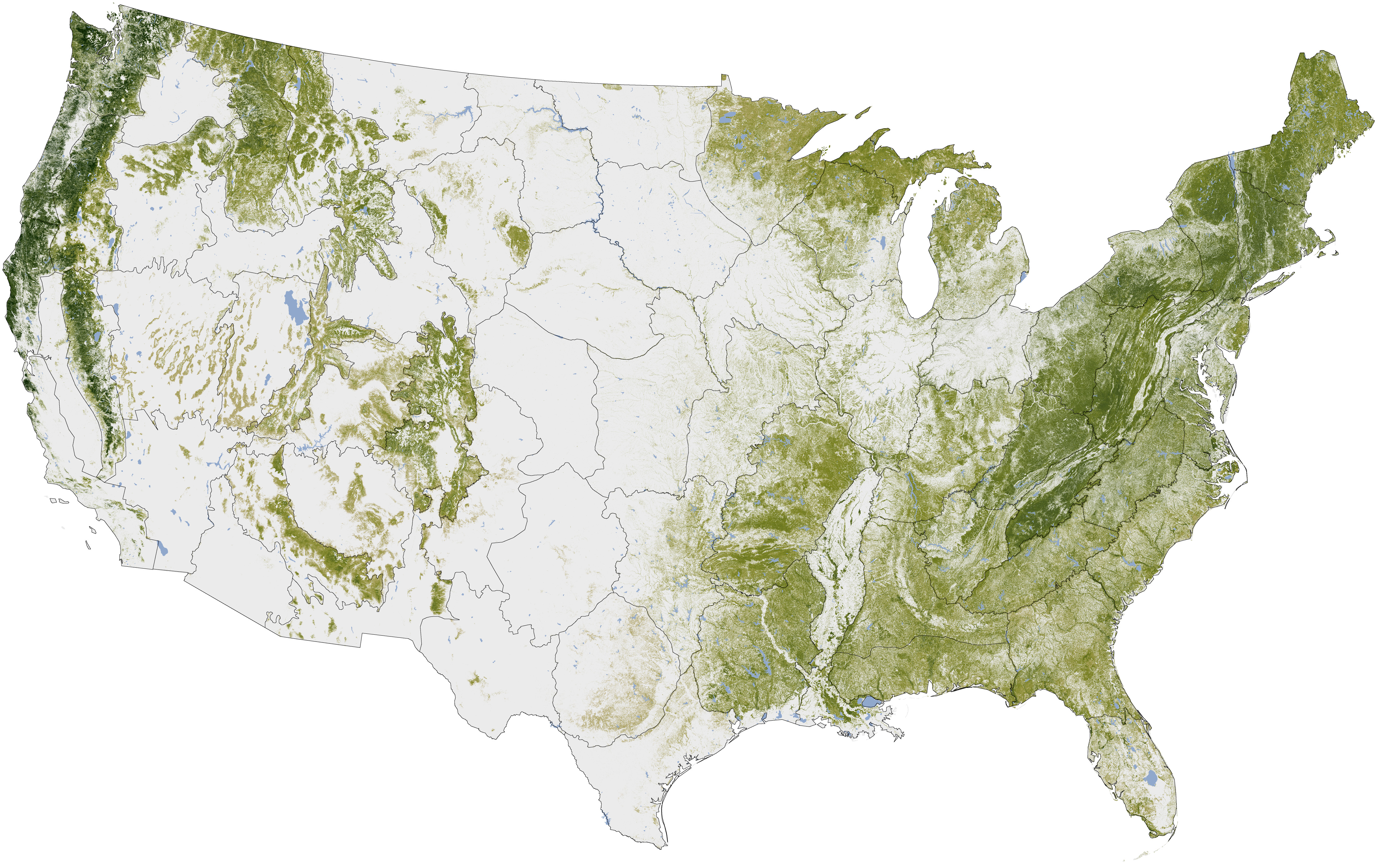
NASA's Earth Observatory shared this image showing the aboveground woody biomass in the mainland United States. The map above was built from the National Biomass and Carbon Dataset (NBCD), released in 2011, which depicts the concentration of biomass (a measure of the amount of organic carbon) stored in the trunks, limbs, and leaves of trees. The Earth Observatory says the darkest greens on the map indicate the areas with the densest, tallest, and most robust forest growth.
You can read more about how the map was compiled here and you can view a very large version of the image here.
Photo: NASA Earth Observatory map by Robert Simmon, based on multiple data sets compiled and analyzed by the Woods Hole Research Center